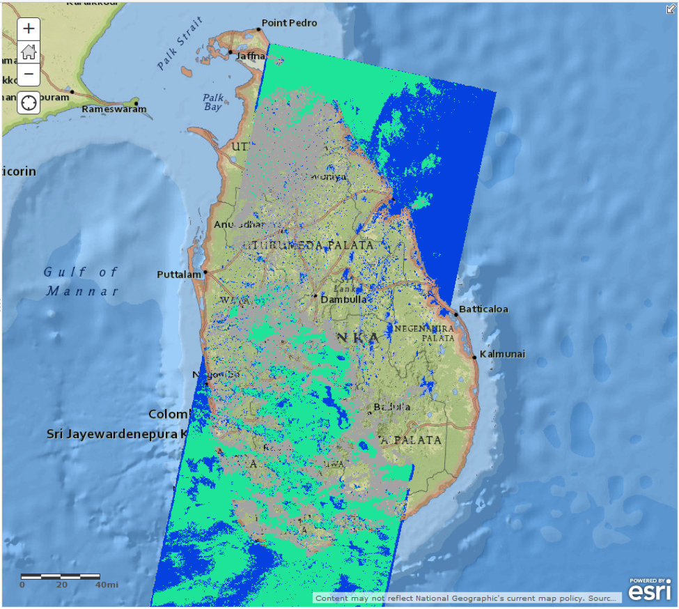
Flood extent map over Sri Lanka from Landsat-8 data. Open water (including oceans) is blue, clouds with open water believed to be underneath are green, and areas completely obscured by clouds are grey.
In May 2016, Cyclone Ruanu dumped upwards of 150-300 mm of rain in less than 3 days over much of Sri Lanka, falling on ground that was already saturated from heavy rain the previous week. The severe flooding and landslides that followed affected over 300,000 people, left over 100 people dead, and caused the equivalent of billions of US dollars in damage. This was the worst flooding in Sri Lanka in at least a quarter century.
Remote sensing can be a critical ally during the early hours and days of disaster response, providing information on conditions in remote areas and places where communications have been interrupted by the disaster. In Sri Lanka, high-resolution optical imagery from the National Aeronautical and Space Administration (NASA) and Terra and Aqua satellites were used to create maps of flood extent at resolutions of several hundred meters, offering an overview of affected areas; additionally, finer-scale flood maps using NASA Earth Observation-1 (EO-1) and Landsat-8 data provided details of damage.
The CEOS Working Group on Disasters (WGDisasters) Flood Pilot team worked with the Humanitarian Open Street Map (OSM) Team or “HOT” to provide both optical and SAR-based flood maps (the latter made available through the International Charter) to the Sri Lanka Disaster Management Center, who in turn shared this information with local, regional, and international coordinating agencies. To make them easy to use, these maps were delivered in multiple formats that were compatible with the information infrastructure already in place at HOT.
Blake Giradot from the Humanitarian Open Street Map Team said it best: “These files are perfect for me and our needs […]. This turned out to be super helpful. Your outreach and forward thinking about open data really does save lives.”