Great Western Woodlands: Australian Ecosystem Extent Demonstrator
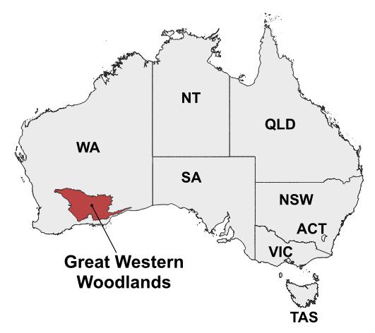
The Great Western Woodlands are the largest remaining area of temperate woodlands on Earth, and carry significant biodiversity and cultural value. The woodlands cover an area of more than 160 000 km2, and are under growing pressure from climate change and land-use intensification. High-quality maps of ecosystem extent are needed to inform conservation, restoration, and adaptation strategies.
In 2022, CEOS formed the Ecosystem Extent Task Team (EETT), who were tasked with delivering a White Paper in 2023, and coordinating demonstration activities in 2024. Great Western Woodlands is one of these three demonstrators, and is led by CSIRO, Australia’s national science agency, under the leadership of Dr Shaun Levick and Dr Adriana Parra Ruiz.
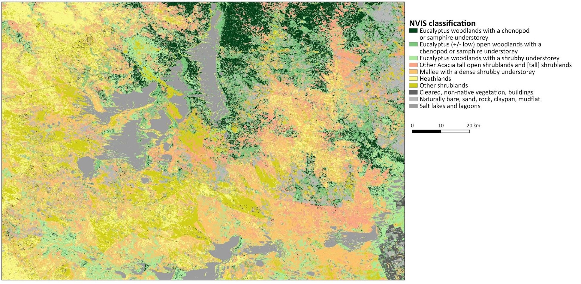
The project aims to map the extent of different vegetation classes at fine resolution (30 m) over the entire region, to understand historic stand growth rates and response to fire disturbances. Some of the key questions to be addressed in the demonstrator include:
- Can stand age be reliably mapped through the integration of multi-sensor satellite imagery?
- Can historic stand growth rates be derived from multi-spectral time-series imagery?
The demonstrator is underpinned by CSIRO’s Earth Analytics Science and Innovation (EASI) platform, which uses Open Data Cube (ODC) technology to organise and analyse data. The work uses multi-modal satellite data: optical imagery from Landsat and Sentinel-2, as well as radar imagery from Sentinel-1 (C-band) and ALOS-2 (L-band).
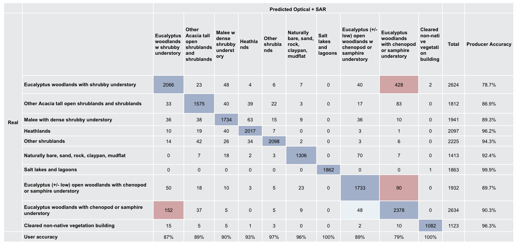
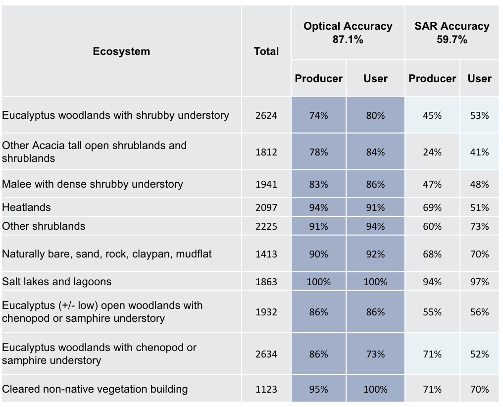
Random forest modelling was used to classify the region into main vegetation subgroups following Australia’s National Vegetation Information System classification scheme. Three random forest models were constructed, using different types of satellite data. The first only used optical data (Landsat and Sentinel-2), the second used only SAR data (Sentinel-1 and ALOS-2), and the third used both optical and SAR datasets. The models used a total of around 45,000 training pixels, and around 20,000 validation pixels. It was found that the optical model performed better than the SAR model, both in overall accuracy and across the user and producer accuracy per class. The optical-only model had a total accuracy of 87.1%, while the SAR model had a total accuracy of 59.7%. However, the multi-modal model out-performed the single-mode models, achieving a total accuracy of 91%. The full results can be seen in the tables to the right.
This work is still in progress, but the team have already learnt some key lessons about how space-based Earth observations can contribute to ecosystem mapping. In particular, the value of multi-sensor / multi-agency imagery and the ability to integrate the datasets easily through analysis-ready data standards and ODC technology was proven to be incredibly important for this type of work. The work CEOS has done to date on these standards and technologies has enabled research like this to occur.
While the Ecosystem Extent Task Team’s work officially concluded at CEOS Plenary 2024, the activity will continue within CSIRO. The work will continue to support CEOS’ broader efforts with biodiversity, in particular through the Biodiversity Study Team initiated in 2024. In 2025 and beyond, the team will look at using more ALOS-2 scenes and higher order products, and using LiDAR products from GEDI for training wall-to-wall canopy height models. They will also use the full Landsat archive (from 1984) to map fire history and fractional cover over time.