Wildfire Coordination: Strengthening Global Fire Monitoring from Space
Wildfires are an essential natural process, but they are also a growing global challenge threatening ecosystems, communities, infrastructure and local economies. Earth observation (EO) satellites provide critical information for both science and applications across the fire management cycle: supporting planning and preparedness before fires occur, monitoring and response during fire events, and post-fire assessment and recovery work. EO data can help identify conditions associated with elevated fire risk, detect and track active fires and smoke, quantify burn extent and severity, and identify long term trends in fire and emissions that have implications for science and policy. In the face of increasing fire activity in many parts of the world, space-based observations are becoming increasingly important for supporting science, policy and operational decision-making across the fire management cycle.
While EO can support all stages of the fire management cycle, to date, CEOS activities have primarily focused on pre-fire and active fire monitoring applications. These applications present unique observational challenges and requirements. Active fire monitoring requires timely and frequent observations, typically in the thermal infrared, due to the rapidly changing nature of actively burning fires. In contrast, pre-fire monitoring relies on a broader range of observations to assess vegetation and fuel conditions that influence the likelihood and potential behaviour of a fire before ignition. No single mission can provide adequate observations for these applications at the global scale. Individual missions carry different sensors, operate in different orbits, and involve trade-offs between spatial resolution, temporal coverage, and observational capabilities. International coordination across satellite missions and organisations is therefore essential to ensure that complementary EO data can effectively support both fire preparedness and active-fire response.
To respond to this challenge, the CEOS Working Group on Disasters (WGDisasters) established the Wildfire Pilot in 2021 with the aim of providing a comprehensive gap analysis for active-fire Earth observation, considering both the data supply and user requirements. The pilot assessed existing and planned satellite capabilities, identified gaps, and gathered information on user needs. A critical part of the project was a global user survey to help CEOS understand how fire-management organisations use satellite observations and what they need from future systems. The results reinforced the importance of timely, reliable and accessible observations, as well as improved coordination between satellite missions and users. The pilot also highlighted that the challenge is not simply having more satellites, but ensuring sufficient coverage, continuity and complementary observations to support global monitoring. The pilot concluded in 2025, and more about the outcomes can be found here.
Following the recommendations of the Wildfire Pilot, CEOS has continued to strengthen international coordination of EO capabilities for wildfire monitoring. In June 2025, G7 members, together with the European Union and leaders from Australia, India, Mexico, South Korea and South Africa, signed the Kananaskis Wildfire Charter to boost international cooperation to prevent, respond to and recover from wildfires, including strengthening readiness and support between countries. In response to the Charter, the Canadian Space Agency (CSA) and Natural Resources Canada (NRCan) led the establishment of the CEOS International EO Wildfire Coordination Group within the Land Surface Imaging Virtual Constellation (LSI-VC). The group provides a forum for coordinating public and non-public, current and planned EO missions relevant to wildfire monitoring, with input from the Global Observations of Forest Cover and Land-use Dynamics (GOFC-GOLD) Fire Science Team.
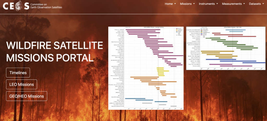
Building on the work of the Wildfire Pilot and in support of the LSI-VC Wildfire Subgroup, the CEOS Missions, Instruments and Measurements (MIM) Database Team recently launched the CEOS Wildfire Satellite Missions Portal to provide a comprehensive and up-to-date overview of current and planned satellite missions that are potentially capable of monitoring active wildfires. The portal builds directly on the work of WGDisasters Wildfire Pilot I, categorises governmental, commercial, and non-governmental missions across Low-Earth (LEO), Geostationary (GEO), and Highly Elliptical (HEO) orbits and features timelines to visualise coverage areas alongside sensor specifications and revisit time. While satellite data can support other stages of the fire cycle, such as fuel-condition monitoring before fires occur and burned-area mapping after fires, the Portal focuses specifically on active-fire monitoring. This is an area where timely and complementary observations are particularly important, and where the range of suitable satellite capabilities remains limited.
CEOS WGDisasters is now extending this work through the Wildfire Preparedness Pilot (2026-2029). While the first pilot focused on active fires, the preparedness activity focuses on pre-fire fuel dryness, including Live Fuel Moisture Content (LFMC), which can provide information on vegetation conditions relevant to wildfire risk and behaviour. Although fuel dryness is important for assessing wildfire risk before ignition, information on fuel moisture can also support response once a fire has started by providing information on fuel conditions that can inform the analysis and prediction of fire behaviour. The preparedness pilot therefore aims to advance globally consistent fuel-dryness indicators to support anticipatory fire management, while also providing information that can contribute to understanding fire behaviour during an active fire.
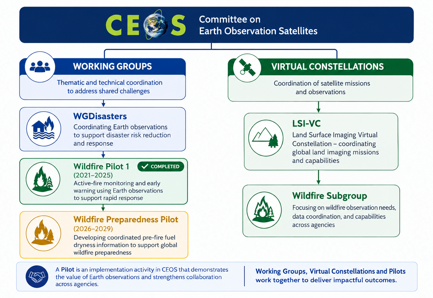
Together, the Wildfire Pilot, CEOS Wildfire Portal, Wildfire Preparedness Pilot and LSI-VC Wildfire Subgroup demonstrate how CEOS is moving from assessing wildfire observation needs to coordinating the international EO capabilities needed to support wildfire preparedness and response, advancing a more coordinated approach to space-based wildfire monitoring.