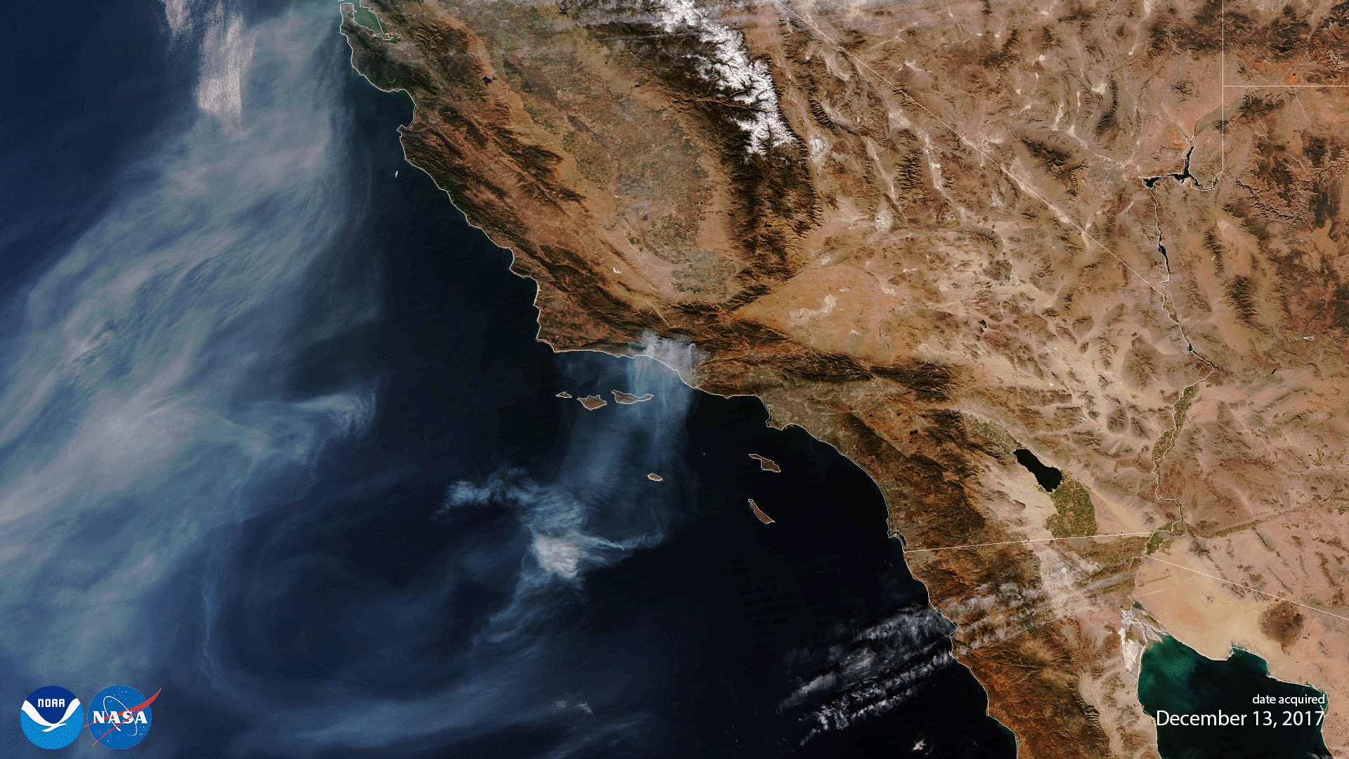
NOAA-20 VIIRS First Light Image Captures One of the Largest Wildfires in California History (Image generated by the NOAA Visualization Lab and NESDIS/STAR)
The National Aeronautics and Space Administration (NASA) launched a new satellite for the National Oceanic and Atmospheric Administration (NOAA) on November 18th, 2017 – one with significantly better imaging capabilities than any of its predecessors. Previously referred to as the Joint Polar Satellite System-1 (JPSS-1) and now, officially known as NOAA-20 after reaching its orbit, this ssatellite joins the Geostationary Operational Environmental Satellite-16 (GOES-16), launched just over a year ago, to provide forecasters unprecedented access to high-quality data.
NOAA-20 is the first in a series of four polar-orbiting satellites, referred to as the JPSS series, equipped with next-generation technology to help improve the timeliness and accuracy of U.S. weather forecasts three to seven days out. The satellite will provide detailed images of the Earth’s surface and observations of atmospheric temperature and moisture, clouds, sea-surface temperature, ocean color, sea ice cover, volcanic ash, and fire detection. In addition to improving weather forecasting, the data will assist emergency managers in responding to natural disasters and help communities recovering from severe storms by providing better views of storm damage and showing the extent of power outages. [ Source ]
Just yesterday (December 13th, 2017), twenty-five days after being launched into Earth orbit, NOAA-20 sent back its first Visible Infrared Imaging Radiometer Suite (VIIRS) science data as part of a series of instrument activation and checkouts that is taking place before the satellite goes into fully operational mode. This VIIRS image captures the aggressive wildfires currently raging across the Southern California region, forcing thousands to flee their homes. As of yesterday morning, the Thomas Fire was the fourth-largest fire in California history, and it continues to generate smoke and plumes as it enters its second week. The fire spanned more than 370 square miles and remains the strongest blaze for firefighters to battle in Ventura and Santa Barbara counties.
Until NOAA-20 has been declared operational, its data are preliminary and will be undergoing testing, but we foresee that NOAA-20 VIIRS will help monitor active fires globally for many years to come. [ Source ]