EO Protecting the World’s Wetlands
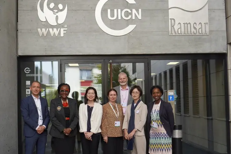 The Japan Aerospace Exploration Agency (JAXA) and the Ramsar Convention on Wetlands recently signed an agreement which will improve the dissemination and democratisation of Earth observation (EO) satellite data for wetland protection. The agreement was made under a Memorandum of Understanding at a special ceremony alongside the Ramsar Convention on Wetlands’ 29th meeting of the Scientific and Technical Review Panel (STRP29) on September 28, 2026.
The Ramsar Convention on Wetlands aims to halt and prevent further worldwide loss of wetlands. To achieve this requires a collaborative effort on an international scale. With this new agreement, the Ramsar Secretariat will gain access to JAXA’s annual global L-band radar mosaics and ALOS-2 ScanSAR data, as well as thematic mangrove and forested wetland products. In return, the Convention will share ground data from the Ramsar Sites Information Service, a database of more than 2500 Wetlands of International Importance.
This agreement supports implementation of the CEOS Agriculture, Forestry, and Other Land Use (AFOLU) Roadmap, which highlights the need for comprehensive and updated geospatial information to map and classify inland and coastal wetlands along with their biomass and health in order to reliably estimate emissions from these ecosystems. The Roadmap also calls on space agencies to ensure every country has access to the relevant satellite data required to report greenhouse gas emissions and removals. The new JAXA-Ramsar agreement will open access for 172 Contracting Party countries and support their tracking and reporting of wetland dynamics.
JAXA has a long history of supporting forests and wetlands, stretching back to the JERS-1 Synthetic Aperture Radar (SAR) satellite in 1992 which had environmental conservation priorities of supporting international environmental agreements, carbon cycle science, and climate. Mosaic maps under the Global Rain Forest Mapping / Global Boreal Forest Mapping (GRFM/GBFM) project established baselines that was expanded during the Kyoto & Carbon Initiative (K&C) and subsequent ALOS forest mapping programs.
The Global Mangrove Watch (GMW) was established in 2011 as a specific project within the Kyoto & Carbon (K&C) Initiative in support of the Ramsar Convention, undertaken as a collaboration between JAXA, Aberystwyth University, Wetlands International and soloEO. Version 4 of the GMW dataset was released on August 4, 2026 and provides a consistent global dataset at 30m of mangrove extent and changes over 4 decades (1985–2025) generated from a combination of optical (Landsat, Sentinel-2) and SAR (JERS-1, ALOS, ALOS-2) data. JAXA’s SAR CEOS Analysis Ready Data (CEOS-ARD) underpins the platform, greatly accelerating generation of this global dataset.
JAXA and ESA have been Observer Organisations to the Ramsar STRP for well over a decade, and are also key participants in GEO Wetlands, which seeks to improve access to EO data, promote co-development of EO tools and products, undertake capacity development, and support the use of EO in national reporting and global assessments.
Space agency support for wetlands is critical, as highlighted in the new STRP Work Plan for the next triennium. The new JAXA-Ramsar MOU will advance countries’ access to this essential data, and initiatives like CEOS-ARD lower barriers to impact.
Wetland Inundation Extent and Duration
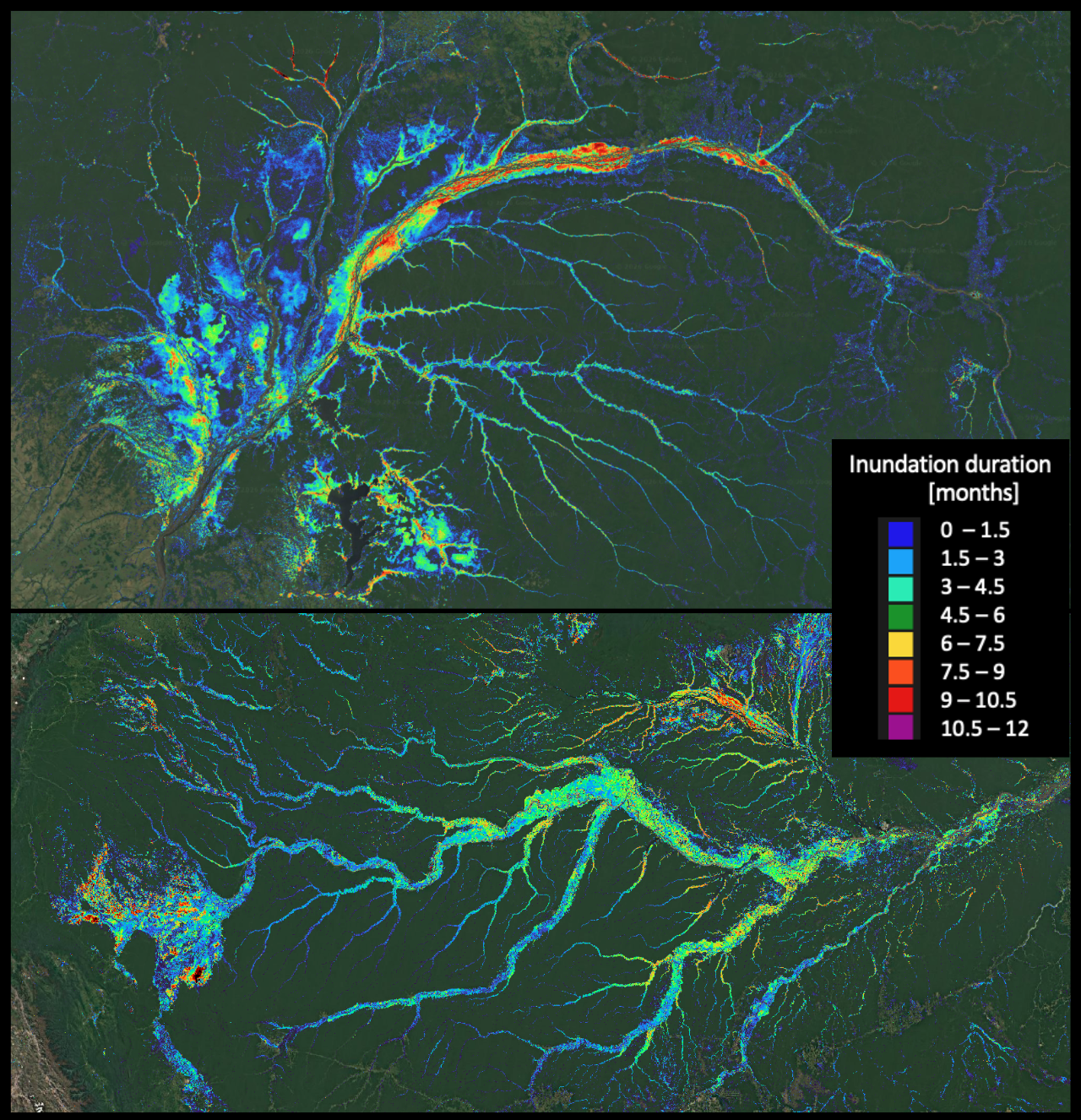
Forested wetlands have been recognised as an information gap by the Ramsar Convention. JAXA and soloEO, using the CEOS Analytics Lab (CAL) and ALOS-2 PALSAR-2 CEOS-ARD [NRB] on AWS, have created annual inundation maps for 2015-2025 which show wetland inundation extent and duration under forest canopies, which can be revealed by the long-wavelength L-band SAR. The images below show inundation duration maps over the Amazon and Congo river basins. These datasets were released to the public on September 29, 2026, and are available for free download below.
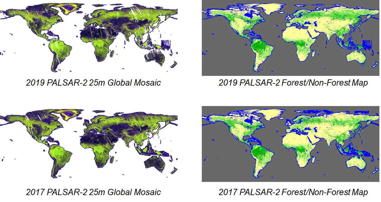
JAXA’s Global PALSAR-2/PALSAR/JERS-1 Mosaics and Forest/Non-Forest Maps
The long wavelength (L-band; ~23.5 cm) Synthetic Aperture Radars (SAR) on JAXA’s JERS-1, ALOS and ALOS-2 are particularly sensitive to vegetation structure. L-band is able to penetrate through the forest canopy and interact with the larger structures such as the trunks and larger branches of trees (see more in A Layman’s Interpretation Guide to L-band and C-band Synthetic Aperture Radar data). Clouds are also transparent to SAR, and this combination therefore makes L-band SAR particularly well suited to provide information about forest changes in tropical regions.
JAXA provides global 25m resolution SAR mosaics and forest/non-forest maps on a free-and-open basis, derived from JAXA’s long heritage of L-band data. The global forest/non-forest maps (FNF) are generated by a Random Forest machine learning-based classification method, with the re-processed global 25m resolution PALSAR-2 mosaic dataset (Ver. 2) as input.