Greenhouse Gas (GHG) Emissions Monitoring: Point Source vs. Wide Area Mappers
Earth observation satellites play an essential role in monitoring potent greenhouse gases (GHGs) like carbon dioxide (CO2) and methane (CH4) by providing global datasets and transparent insights that help scientists, policymakers, and organisations to track and manage emissions and removals. Different types of sensors are needed to track CO2 and CH4 emissions on different spatial scales around the Earth. GHG observations from space are broadly categorised into two scales: wide area / global scale and point source / facility scale.
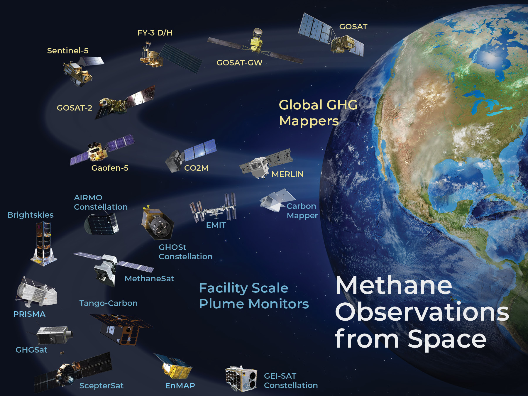
GHG wide area mappers, also known as global GHG mappers, are satellite sensors designed to monitor GHG concentrations over large geographical regions with the sensitivity and repeat frequency needed to track regional and global trends. These systems typically consist of high spectral-resolution imaging spectrometers optimised to quantify CO2 and CH4 concentrations with accuracies as high as 0.25% at spatial resolutions as fine as 2 km. Their data are used for monitoring CO2 and CH4 emissions and removals on spatial scales spanning large urban areas to entire nations, with coverage across wide swaths up to 2600 km. Wide area mappers therefore provide a transparent method for developing and validating national GHG inventories and assessing collective progress toward national GHG emission reduction goals. They also provide the sensitivity needed to track atmospheric CO2 and CH4 variations associated with weak, spatially-extended natural sources and sinks, such as forests or wetlands, which are evolving rapidly in response to human activities and climate change. With their focus on global monitoring and ability to support international climate frameworks, wide area mappers have typically been operated by public space agencies.
Greenhouse gas point source mappers, also known as facility scale plume monitors, use high-spatial- resolution multispectral or hyperspectral imagers to detect and quantify emissions from concentrated point sources such as industrial facilities, power plants, and landfills. Point source mappers are operated by a mix of public, commercial and non-governmental organisations, who primarily focus on aiding the fossil fuel sector in mitigating emissions, particularly from CH4 extraction and transportation. These missions exploit observations collected by small, purpose-built satellites with dedicated GHG instruments, as well as hyperspectral and multispectral imagers, such as those onboard Landsat and Sentinel-2. These sensors are optimised for detecting individual CO2 and CH4 plumes, and pinpointing their exact locations so that steps can be taken to mitigate their impact.
Point source mappers have very high spatial resolution (typically less than 100 metres) but a limited coverage compared to wide area mappers. Innovative techniques, such as the tip and cue approach, combine the capabilities of these two sensor types. In a tip and cue application, if a global mapper detects increased emissions in a particular area, its lower resolution data is shared with point source mapper teams so that their satellites can be tasked with pinpointing the source as soon as possible.
Both the global mappers and point source mappers have unique capabilities that are critical for monitoring GHG emissions and mitigating their impact on our climate. While more commercial and non-governmental entities are launching new point source mappers, public agencies need to continue supporting wide area mappers to ensure we can effectively monitor GHGs on policy-relevant spatial and temporal scales.
The CEOS Greenhouse Gas Satellite Missions Portal aims to provide a comprehensive and up-to-date list of all current and planned satellite missions capable of measuring greenhouse gases. This includes missions planned and operated by public and commercial organisations, and is based on data from the CEOS Missions, Instruments, Measurements (MIM) Database. The portal will be updated in September 2024, to reflect the latest mission information. This resource supports the Greenhouse Gas Roadmap being implemented by CEOS and CGMS Agencies.