Hudson Bay Lowlands: Canadian Ecosystem Extent Demonstrator
 The lowlands of Canada’s Hudson Bay span 320,000 square kilometres and are home to vast and diverse landscapes and ecosystems. It is also the country’s densest region of carbon stock. The region was selected by the CEOS Ecosystem Extent Task Team (EETT) to convey how satellite remote sensing is essential for mapping and monitoring ecosystems.
The overall and ongoing objectives of the project are:
- Develop a standardised ecotype mapping approach with machine learning, AI, cloud computing, and EO to operationally monitor biodiversity across the Hudson Bay Lowlands and eventually all of Canada.
- Standardise vegetation ecotypes to the IUCN 2.0 Typology, a comprehensive hierarchical classification framework for Earth’s ecosystems. This seeks to map all of Canada to Level 3 (Functional Groups) by 2026.
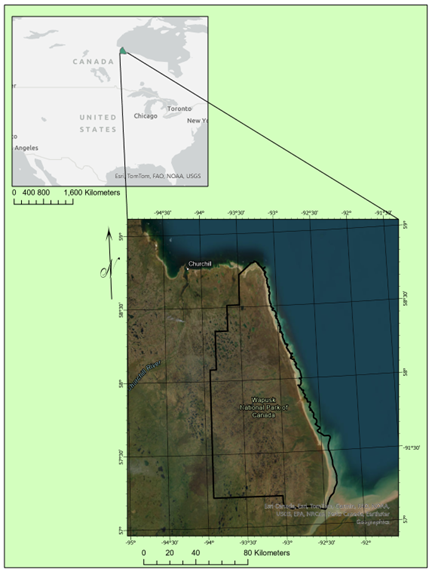
This ongoing work in the Lowlands leveraged efforts by Environment and Climate Change Canada (ECCC). Within the Hudson Bay Lowlands, EETT selected Wapusk National Park as a demonstrator site, which had the following objectives:
- Determine what sensors contribute most to the discrimination of ecotypes for biodiversity monitoring.
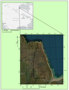
Wapusk National Park
- Determine and resolve roadblocks for utilising these datasets in an operational capacity.
- Determine which Remote Sensing classification methods are useful from an operational perspective including machine learning algorithms such as Random Forest, and deep learning algorithms such as Convolutional Neural Networks and U-NET Neural Networks.
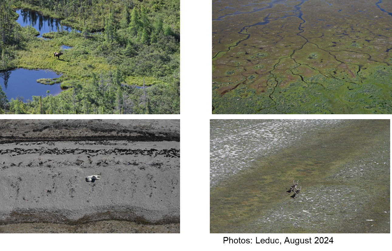
- Develop and improve helicopter-based ecosystem surveying for in situ data collection.
The Hudson Bay Lowlands Biodiversity Conservation and Sequestration Initiative started after the UNFCCC 26th Conference of Parties (COP 26) in 2021. It seeks to assess biodiversity and carbon values, in particular for peatland, wetland, coastal, and marine ecosystems across the Lowlands, and to connect Western and Indigenous knowledge to promote conservation efforts. The project also aims to support emission reductions across Canada as well as address Target 21 of the Global Biodiversity Framework.
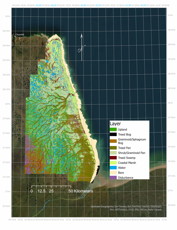
EETT classified the ecosystems and ecotypes in Wapusk National Park by combining multiple EO sensors and in situ data sources, using Machine Learning (ML) and Deep Learning classifiers both locally and within the CEOS Open Data Cube (ODC). The park was mapped according to the IUCN 2.0 Typology, beginning with five Functional Groups from the Canadian Wetland Inventory (CNWI): Swamp, Bog, Fen, Marsh, and Upland (Tundra). These were then expanded into more detailed classifications and ecotypes to generate a comprehensive ecosystem classification of the region.
Field campaigns commenced 2024 in the Hudson Bay Lowlands using helicopter transects, air calls, and ground plot sampling for validation of the air-based observations. The entire Lowlands region has been mapped to the generalised wetland classes with Landsat temporal data, ALOS 2 – PALSAR-2 global mosaic, SRTM Digital Elevation Model (DEM) and derivatives, Sentinel-2 optical data and derivatives, and two dates of Sentinel 1 Synthetic Aperture Radar (SAR) data.
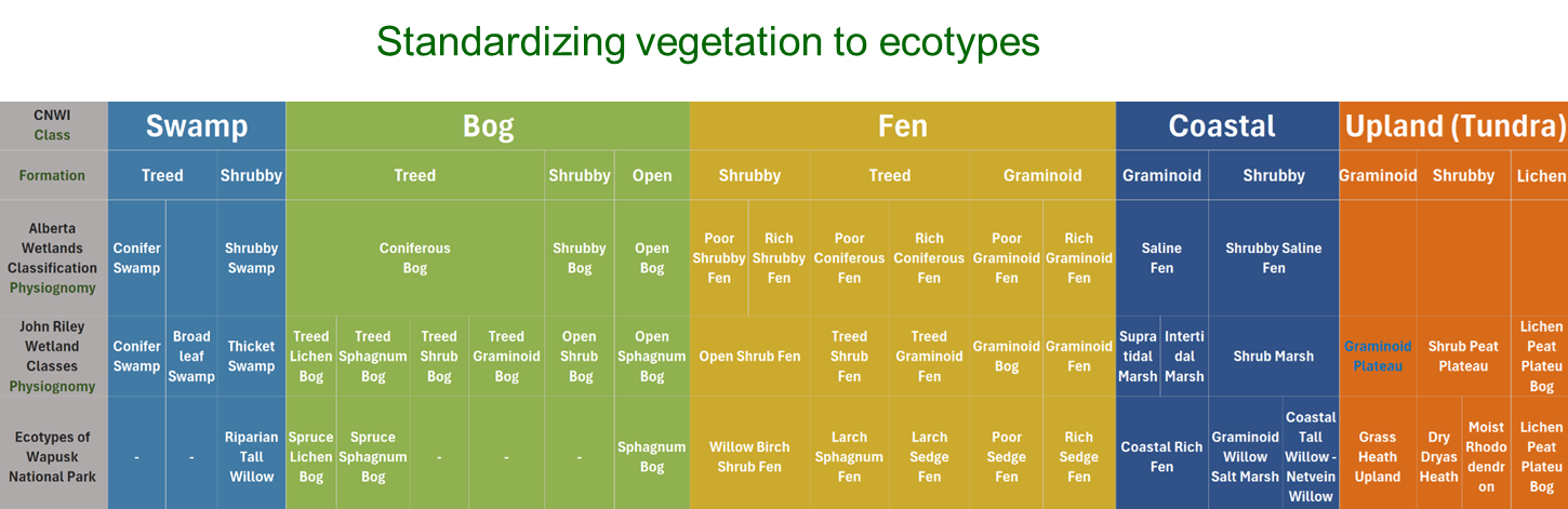
Standardised vegetation types according to the IUCN Global Ecosystem Typology used in the mapping of Wapusk National Park
Wapusk National Park was mapped in greater ecosystem detail using SAR imagers onboard Sentinel-1, The RADARSAT Constellation Mission, and ALOS-2’s Phased Array type L-band SAR-2 (PalSAR-2). A 12 m DEM derived from TanDEM-X imagery and derivatives, as well as hyperspectral imagery from EnMAP were also assessed.
This data acquired and processed throughout the demonstrator project highlighted new opportunities for intercomparison studies between hyperspectral and SAR data with machine learning and deep learning for ecosystem classification. Furthermore, it provides a foundation for the continued development of space-based EO for ecosystem mapping and led EETT to investigate the geographic portability of the methods used and evaluate the ecosystem parameters that can be derived from each data type. Read more about ecosystem mapping from space.
Ecotype Map of Wapusk National Park