P-VC: What Have They Been Up To?
This article is the sixth in a series of seven articles describing the role and work of the CEOS Virtual Constellations. The series of articles is as follows:
- Atmospheric Composition (AC-VC)
- Land Surface Imaging (LSI-VC)
- Ocean Colour Radiometry (OCR-VC)
- Ocean Surface Topography (OST-VC)
- Ocean Surface Vector Wind (OSVW-VC)
- Precipitation (P-VC) (this article)
- Sea Surface Temperature (SST-VC) (coming soon)
The CEOS Virtual Constellations (or ‘VCs’) are defined as “a set of space and ground segment capabilities operating together in a coordinated manner, in effect a virtual system that overlaps in coverage in order to meet a combined and common set of Earth observation requirements.” The interim goal of each VC is to demonstrate the value of a collaborative partnership in addressing a key observational gap, while the end goal is to sustain the routine collection of critical observations. For more on what the VCs are in general, see the process paper.
Established in 2007 as one of the four prototype CEOS Virtual Constellations, the Precipitation Virtual Constellation (P-VC) exists to sustain and enhance a systematic capability to observe and measure global precipitation. Accurate and timely knowledge of global precipitation is needed for improving predictive skills of high-impact weather events such as hurricanes, floods, droughts, and landslides, as well as the management of freshwater resources. The spatial and temporal variability of precipitation necessitates the combination of data from multiple satellites to ensure representative sampling across the range of scales (spatially and temporally) that is required by worldwide research and operational user communities.
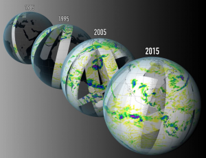
Led by NASA and JAXA, the P-VC’s primary role is to establish an international framework to guide, facilitate, and coordinate the continued advancement of multi-satellite global precipitation measurement. One of the major achievements of P-VC has been the implementation of the Global Precipitation Measurement (GPM) constellation, with the launch of the GPM Core mission in 2014. Currently, the constellation is formed of 10 microwave imagers and sounders, and five geostationary satellites providing infrared data.
Precipitation was identified by the Global Climate Observing System (GCOS) as an Essential Climate Variable (ECV), and hence P-VC has also worked on sustaining and enhancing an accurate and timely global precipitation data record including a Fundamental Climate Data Record fit for the purpose of monitoring precipitation.
P-VC supports CEOS by:

Figure from “The Global Satellite Precipitation Constellation: current status and future requirements”, Kidd et al., 2021.
- Maintaining and enhancing the precipitation constellation through current missions, including continuation of precipitation-capable missions beyond end-of-life (where practical) and for generating mitigation strategies where necessary;
- Developing and integrating new satellites and sensors to provide a viable and sustainable precipitation constellation, including new technologies (such as EPS-SG, AMSR3, CMIR, AOS/ACCP, etc)
- Creating and refining retrieval schemes to provide precipitation products to the research and user communities, from near real time instantaneous products through to climate-scale data records.
- Validating precipitation products through maintaining, expansion and exploitation of global ground validation (e.g. USA, Europe, S.Africa, S.America, Japan, S.Korea, India, Australia, etc).
P-VC is an integral part of the larger precipitation community with direct involvement with the GPM (both NASA and JAXA) science teams and the Coordination Group on Meteorological Satellite’s (CGMS) International Precipitation Working Group (IPWG).
In 2021, P-VC generated a White Paper for CEOS which was published a paper in the Bulletin of the American Meteorological Society titled “The Global Satellite Precipitation Constellation: Current Status and Future Requirements”. This paper provides recommendations to ensure the long-term continuity of global satellite precipitation observations based upon the current precipitation constellation and planned missions
P-VC also contributed to two papers from CGMS IPWG:
- IPWG Report on Space Radar Applications in June 2021, and
- The Joint IPWG/GEWEX Precipitation Assessment in July 2021