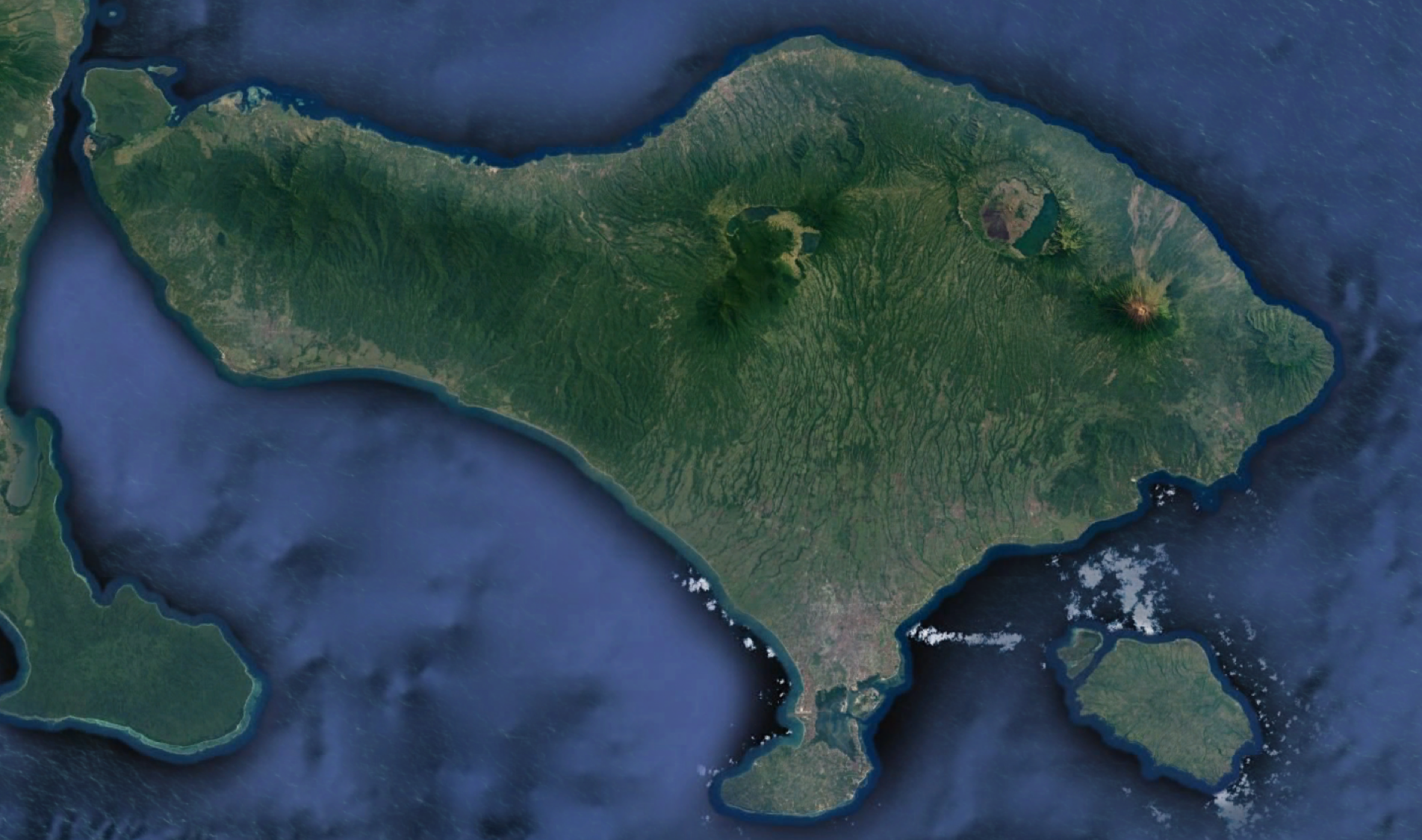
 The CEOS Working Group on Disasters was featured in Newsweek last week for it’s Volcano Pilot activities in response to the Agung volcano eruption on the island of Bali, Indonesia last November after over 50 years of quiescence. The last Agung eruption, in 1963-64, caused the deaths of over 1000 people, so careful monitoring of the volcano is critical.
Volcanologists are collecting a wide array of data to help them understand the volcano’s activity, including seismic, gas, and GNSS, but visual observations are of fundamental importance, and there is no safe and easy way to look into the crater of this 3000 m high volcano.
The WGDisasters is helping geophysicists access and use satellite data – from Synthetic Aperture Radar (SAR) instruments in particular – to provide an “eye in the sky” that can “see” through clouds – a critical capability in cloudy, tropical environments.
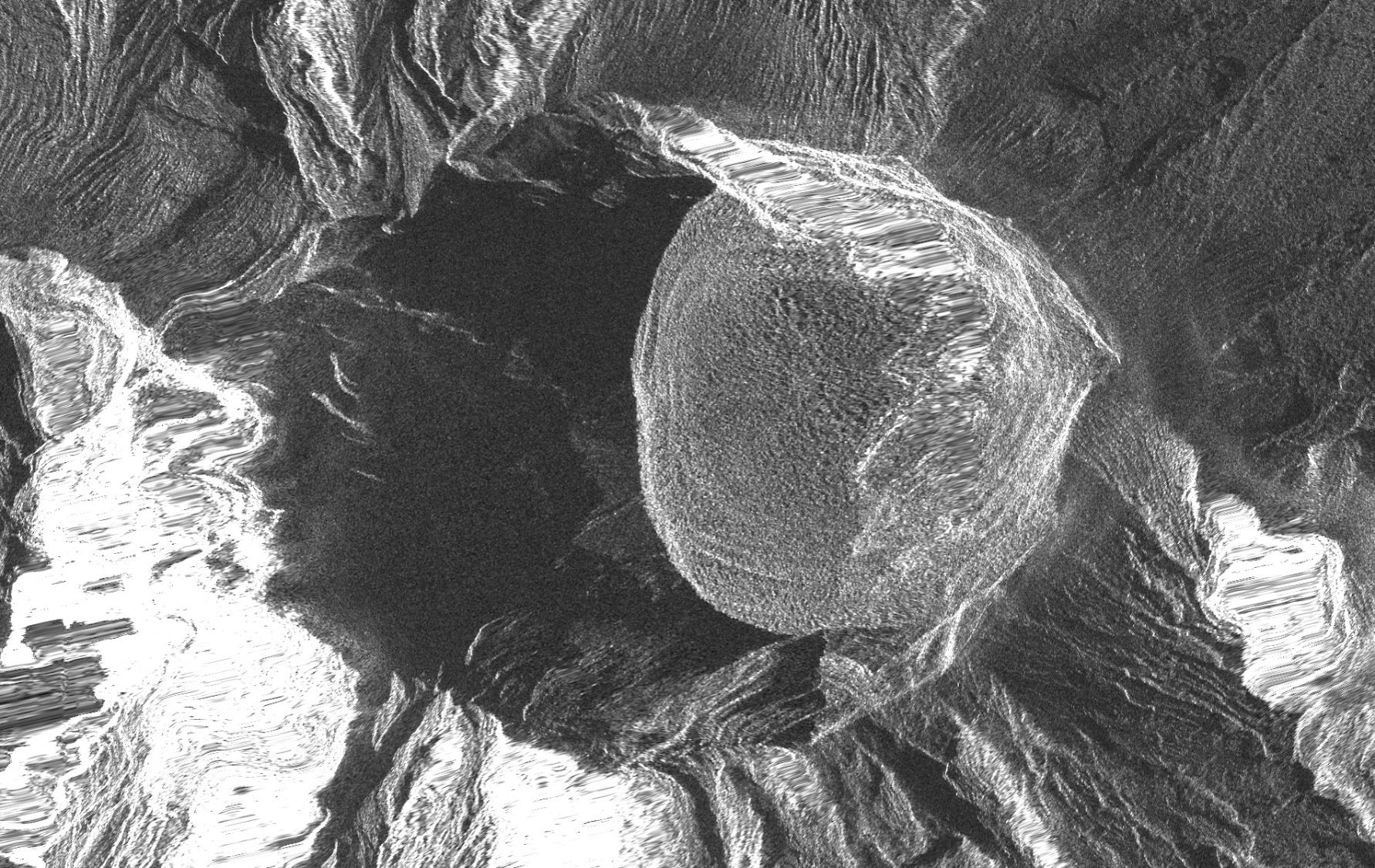 Since the start of the eruption, multi-temporal, high-resolution images from COSMO-SkyMed satellites have offered an unprecedented view of the growing lava surface within the volcano’s crater, which appears quite smooth and relatively low in viscosity.
Understanding how the lava shape and amount changes over time is critical information for the Indonesian volcanologists tasked with forecasting Agung’s future behavior, a perfect example of how satellite Earth observations can help inform decisions for disaster preparedness and response.