From Inland Waters to Open Oceans: Version 2 of the CEOS-ARD Aquatic Reflectance Specification
The CEOS Analysis Ready Data (CEOS-ARD) Product Family Specifications (PFS) are a suite of documents that detail minimum requirements for ‘analysis ready’ satellite Earth observation data across various domains. Ensuring datasets are compliant with the CEOS-ARD PFS means they should be more suited to immediate analysis by more users with a minimum of additional effort, and support interoperability both through time and with other datasets.
To date, CEOS has produced Product Family Specifications for Surface Reflectance, Surface Temperature, Aquatic Reflectance, Nighttime Lights Surface Radiance, and Synthetic Aperture Radar datasets. These specifications assist data producers, distributors, and users by providing a consistent benchmark for what is considered ARD.

First published in 2022, the Aquatic Reflectance (AR) PFS provided guidance for satellite data products focused on inland, nearshore coastal, and optically shallow waters, with an additional emphasis on high resolution sensors. Open oceans were excluded from this first version due to a lack of community consensus, along with the challenge of consolidating kilometre-scale open ocean pixels and sub-hundred metre coastal pixels without a common geolocation referencing system. However, increased interest from the ocean community led the CEOS Ocean Colour Radiometry and Land Surface Imaging Virtual Constellations (OCR-VC and LSI-VC), in collaboration with the International Ocean Colour Coordinating Group (IOCCG), to update the specification to accommodate the breadth of aquatic reflectance applications.

This image of the Mackenzie River Delta in Canada captured by Landsat-8’s Operational Land Image (OLI) in 2017 shows turbid fresh water flowing into the Beaufort Sea, highlighting the stark contrast and complexity between different water bodies and their observation.
In mid-2024, the update was initiated to define a single AR PFS covering all aquatic domains, with new requirements for general and per-pixel metadata, as well as products, algorithms, and geometric corrections. The effort saw the creation of new metadata requirements, including for ‘Geometric Correction and Orthorectification’, in recognition of the loss of terrestrial reference systems over open oceans. In parallel, the existing Threshold and Goal metadata requirements were updated and are planned to propagate through all optical CEOS-ARD PFS, ensuring consistency, robustness, and reliability across the PFS and their compliant products.
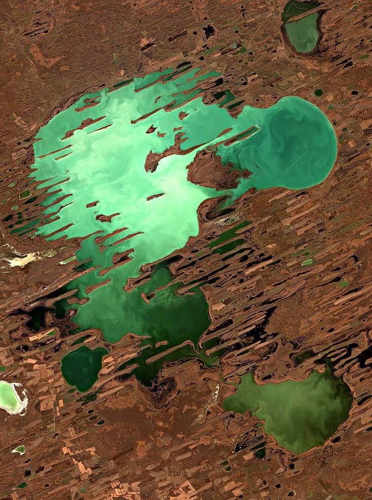
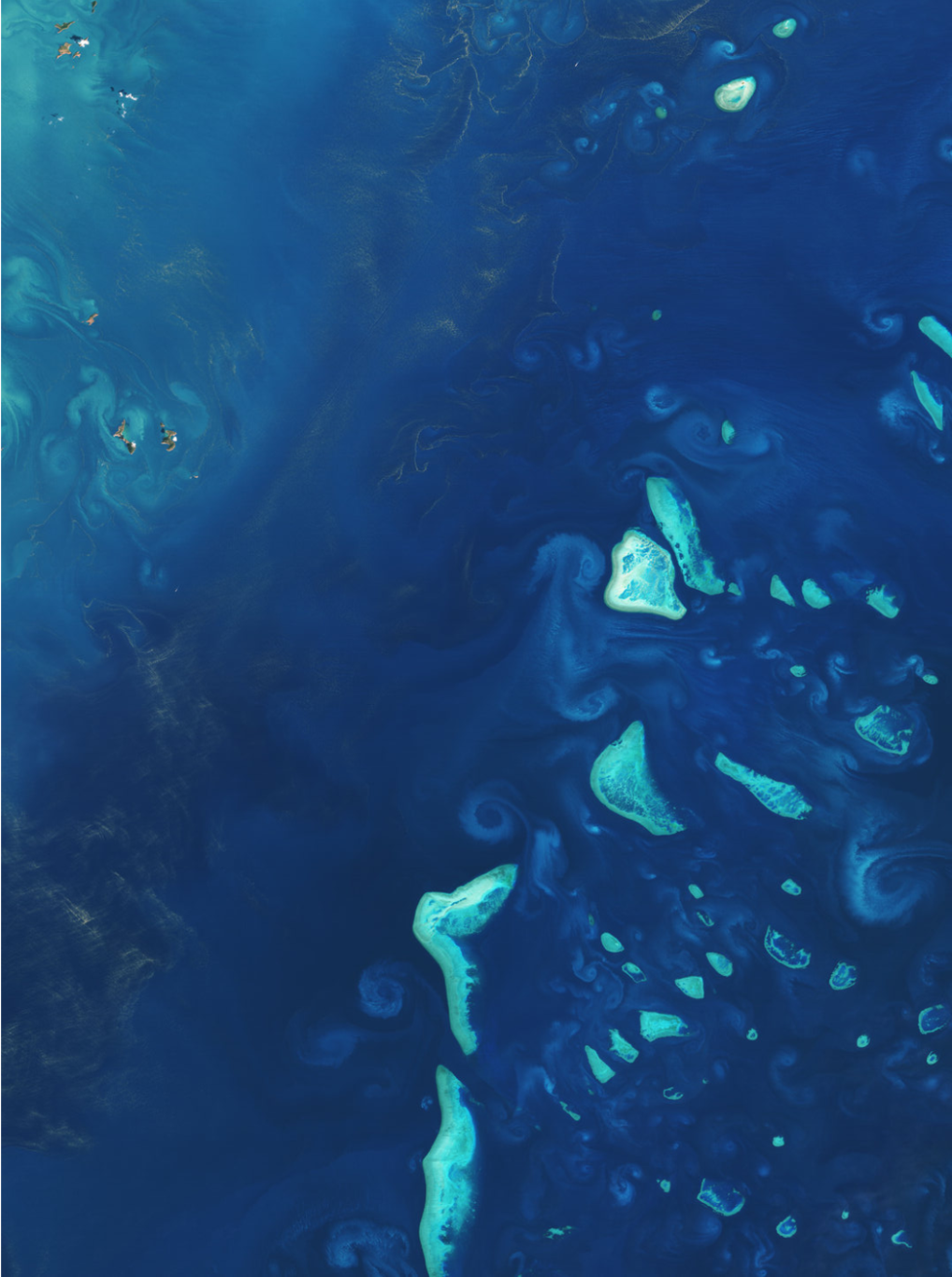
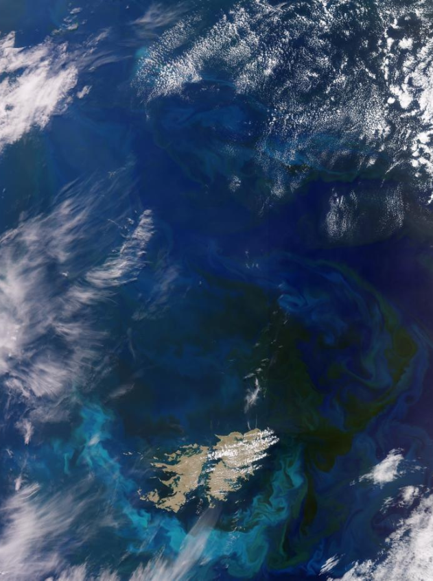
Lake Chany, Russia [Sentinel-2/MSI], the Great Barrier Reef, Australia [Landsat-8/OLI], and the South Atlantic Ocean [Sentinel-3/OLCI].
Version 2 of the Aquatic Reflectance PFS was endorsed by OCR-VC, LSI-VC, and IOCCG in May 2025. The PFS applies to:
Data collected with multispectral and hyperspectral imaging sensors operating in the VIS/NIR/SWIR wavelengths over water bodies (including oceans, seas, coastal zones, and inland waters). These typically operate with ground sample distance and resolution in the order of 1-4000 metres however the specification is not inherently limited to these resolutions.
Satellite data providers interested in complying with the Aquatic Reflectance PFS are encouraged to reach out to the CEOS-ARD team at ard-contact@lists.ceos.org, and review the PFS available at ceos.org/ard. A guide for submitting data provider self-assessments is available here.