The Ocean Surface Topography Virtual Constellation (OST-VC) goal is to implement a sustained, systematic capability to observe the surface topography of global oceans from the basin scale to the mesoscale (~ 100 km). The surface topography from satellite altimeters and the upper-ocean density field from Argo profiling floats are oceanic analogues to the surface pressure from barometers and the density field from atmospheric profilers. Observations of these two fundamental state variables are necessary for understanding the dynamics of the oceans, assessing their role in climate, and developing an operational forecast capability.
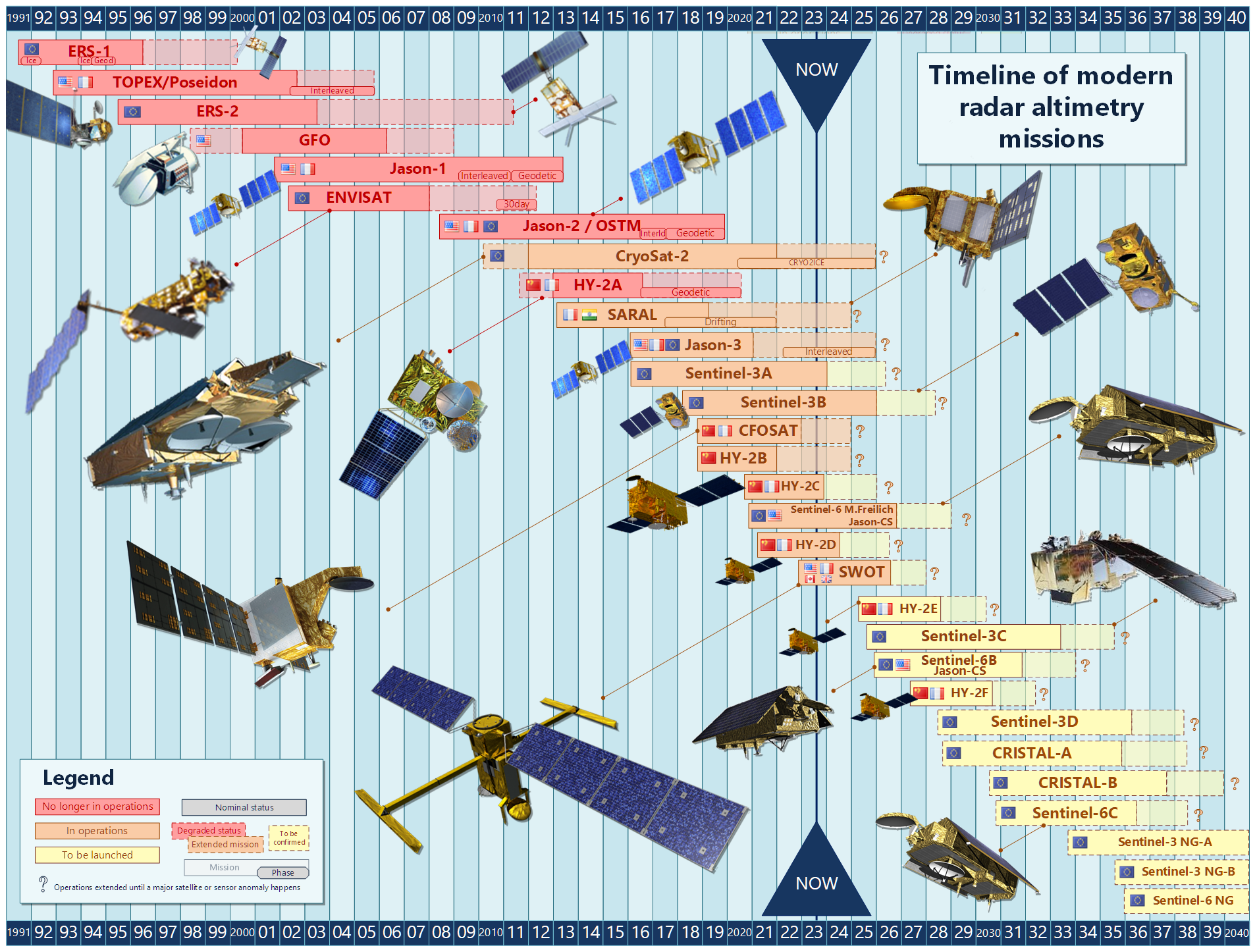
Altimetry Timeline
Meetings
All past OST Science Team (OSTST) Meeting information & materials are accessible via the AVISO+ website (AVISO+ = Archiving, Validation, and Interpretation of Satellite Oceanographic Data).
Contact Us
Please feel free to contact the OST-VC for more information:
Yannice Faugere (French Space Agency, CNES)
Estelle Obligis (European Organisation for the Exploitation of Meteorological Satellites, EUMETSAT)