The Land Surface Imaging Virtual Constellation (LSI-VC) exists to maximize the value derived from CEOS Agency land surface imaging assets and activities by providing an overarching coordination role.
The responsibility of the LSI-VC is to facilitate coordinated and optimized land surface imaging contributions from CEOS Agencies to enable access to fundamental measurement products in support of confirmed/validated requirements linked to adopted CEOS priorities. These priorities are typically derived from scientific users and key stakeholders, such as UN agencies/programs and GEO.
Specifically, the LSI-VC applies a CEOS multi-agency perspective to the following activities:
- Assessing land surface imaging data requirements, identifying the fundamental measurements that are required from land surface imaging assets to meet them, and undertaking gap analyses.
- Facilitating the coordination of mission development to ensure the overall set of space assets is optimized, within the supplying organizations’ abilities and constraints, to support the overall package of validated data requirements.
- Harmonizing, based on inputs received, periodic acquisition planning to optimize asset use; helping to resolve competing requirements; and promoting resilience and redundancy of the Virtual Constellation.
- Support the coordination of the retrieval and reprocessing of historical products to fill gaps in archives where required to support validated time series analysis requirements.
- Support the coordination of the implementation of consistent calibration and pre-processing approaches so that observation data are used to produce comparable fundamental measurement products for user benefit.
- Support the implementation of CEOS land surface imaging data processing, distribution and analysis capabilities (such as those being developed by the CEOS Systems Engineering Office (SEO) and the Working Group on Information Systems and Services (WGISS)), which enable the broadest user access to fundamental measurements for generating derived products.
More information: Land Surface Imaging Virtual Constellation (LSI-VC) Terms of Reference (3 July 2024).
Subgroups
The 2019 CEOS Plenary endorsed the transition of the Ad Hoc Space Data Coordination Group for GFOI to become a thematic subgroup on Forests & Biomass within LSI-VC, and likewise endorsed the transition of the Ad Hoc CEOS Working Group on GEOGLAM to become a thematic subgroup on GEOGLAM. These subgroups are dedicated to a specific thematic area and will maintain their relationships with their respective stakeholders and user communities. They will focus on data acquisition and requirement strategies for their thematic areas, which will feed into the overall requirements worked by LSI-VC.
CEOS Analysis Ready Data (CEOS-ARD)
CEOS Analysis Ready Data (CEOS-ARD) are satellite data that have been processed to a minimum set of requirements and organized into a form that allows immediate analysis with a minimum of additional user effort and interoperability both through time and with other datasets.
More information is available on the CEOS Analysis Ready Data website.
CEOS AFOLU Roadmap
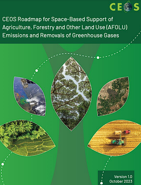
The CEOS Agriculture, Forestry, and Other Land Use (AFOLU) Roadmap provides a long-term (+15 years) framework to guide the coordination of Earth observation satellite programs by CEOS agencies. It aims to address the growing societal need for reliable AFOLU-related information, with a particular emphasis on supporting the Global Stocktake process under the 2015 Paris Climate Agreement.
The Roadmap serves as a guiding vision for sustained space agency cooperation, focusing on three key areas: (1) characterizing user needs, services, and applications; (2) identifying the Earth observation products and observing systems that can meet those needs; and (3) emphasizing the importance of planning for ground segment, space segment, and data services.
At LSI-VC-16, LSI-VC affirmed its support for the AFOLU Roadmap and agreed that the LSI-VC Subgroup will act as the body responsible for tracking and reporting on the implementation of the Roadmap’s actions.
Some Documents
- CEOS Analysis Ready Data (CEOS-ARD) Strategy 2024
- CEOS Analysis Ready Data Governance Framework
- CEOS Interoperability Terminology
- WGISS Interoperability Handbook (Feb 2008, v1.1)
- Land Surface Imaging Virtual Constellation (LSI-VC) Terms of Reference (3 July 2024)
Meetings
- LSI-VC-17: Tsukuba, Japan | April, 2025
- LSI-VC-16: Canberra, Australia | September, 2024
- LSI-VC-15: Tokyo, Japan | April, 2024
- LSI-VC-14: Frascati, Italy | October, 2023
- LSI-VC-13: Frascati, Italy | March, 2023
- LSI-VC-12: Frascati, Italy | September, 2022
- LSI-VC-11: Virtual Meeting | May, 2022
- LSI-VC-10: Virtual Meeting | May, 2021
- LSI-VC-9: Virtual Meeting | April – May, 2020
- LSI-VC-8: Anchorage, Alaska, USA | September, 2019
- LSI-VC-7: Hanoi, Vietnam | February, 2019
- LSI-VC-6: Ispra, Italy | September, 2018
- LSI-VC-5: Tokyo, Japan | February, 2018
- LSI-VC-4: Frascati, Italy | September, 2017
- LSI-VC-3: Frascati, Italy | March, 2017
- LSI-VC-2 : Los Angeles, California, USA | July, 2016
- LSI-VC-1 : Frascati, Italy | February, 2016
Contact Us
Please feel free to contact the LSI-VC Co-Chairs for more information:
Christopher Barnes
Sustainable Land Imaging Partnerships, Landsat Science Office
U.S. Geological Survey (USGS)
Jonathon Ross
Geoscience Australia (GA)
Peter Strobl
Scientific / Technical Project Officer
European Commission Joint Research Centre (EC/JRC)
Takeo Tadono
Associate Senior Researcher Earth Observation Research Center
Japan Aerospace Exploration Agency (JAXA)
The following CEOS Agencies are involved in LSI-VC:
- Agenzia Spaziale Italiana (ASI)
- Centre national d’études spatiales (CNES)
- Comisión Nacional de Actividades Espaciales (CONAE)
- Canadian Space Agency (CSA)
- Commonwealth Scientific and Industrial Research Organisation (CSIRO)
- Deutsches Zentrum für Luft-und Raumfahrt (DLR)
- European Commission (EC)
- European Space Agency (ESA)
- Geoscience Australia (GA)
- Geo-Informatics and Space Technology Development Agency (GISTDA)
- Indian Space Research Organisation (ISRO)
- Japan Aerospace Exploration Agency (JAXA)
- Korea Aerospace Research Institute (KARI)
- National Aeronautics and Space Administration (NASA)
- National Oceanic and Atmospheric Administration (NOAA)
- South African National Space Agency (SANSA)
- United Kingdom Space Agency (UKSA)
- United States Geological Survey (USGS)
- Vietnam Academy of Science and Technology / Vietnam National Space Center (VAST/VNSC)
Past LSI meeting materials are available upon request.