In June 2024, the pre-operational RO was activated by UNDP for floods in Armenia. In May 2024, heavy rainfall and consequent floods hit northern Armenia, particularly Lori and Tavush Provinces, where the rivers Debed, Aghstev and Tashir all burst their banks washing away roads, bridges, parts of a railway and flooding towns and villages located along them. The floods caused casualties and hundreds of people experienced power cuts and had to evacuate the affected areas.
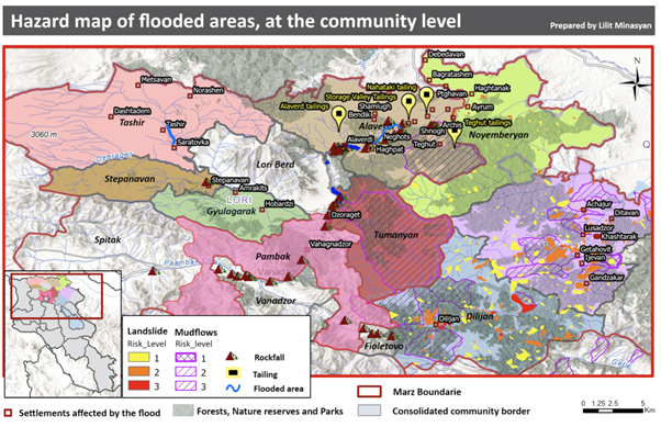
Hazard map of flooded areas, produced by Lilit Minasyan for UNDP
The International Charter ‘Space and Major Disaster’ and the Copernicus EMS Risk and Recovery have also been activated for disaster response and assessment of post-flood landslide risk, respectively.
SERTIT’s Rapid Mapping Service has been working closely with the RO, EC and UNDP providing information about:
- The localisation, qualification and quantification of debris
- The estimation of the flood propagation as well as flood simulations in the river basins
- The potential of the flood triggering landslides.
The role of RO LIaison Officer was played by SERTIT.
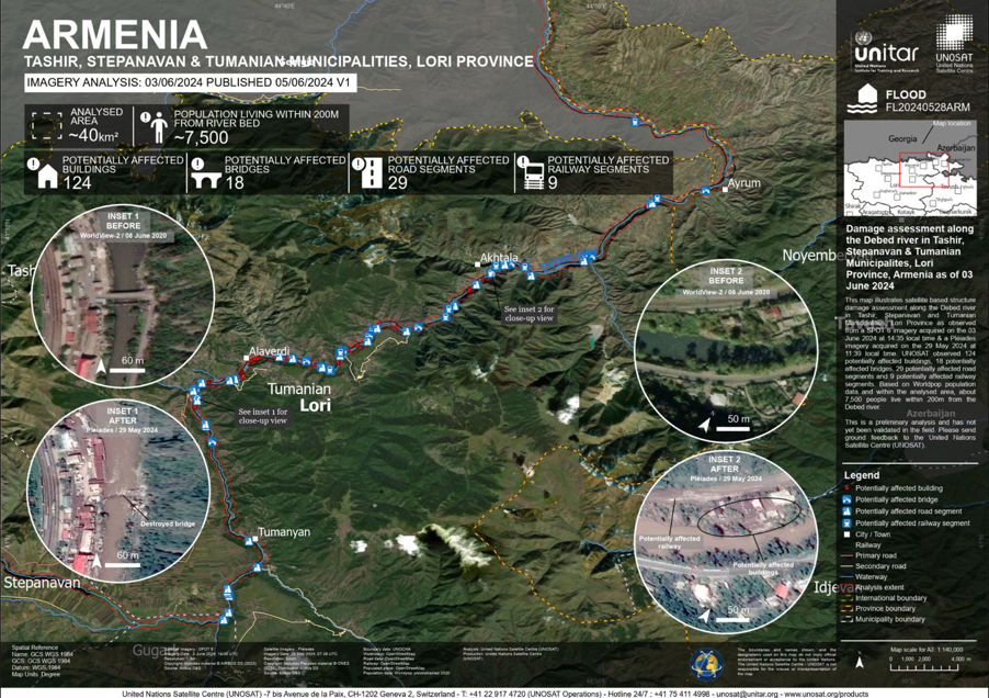
Flood damage assessment along the Debed river in Tashir, Stepanavan & Tumanian Municipalites, Lori Province, Armenia Copyright: Includes material © AIRBUS DS (2024), Map produced by Unitar / UNOSAT
Other RO products for the floods in Libya can be found here.