Overview
Globally, wildfires burn nearly 4.3M km2 every year. Climate is one critical factor that influences fire regimes, and warmer and drier conditions as a result of climate change, compounded by population growth and expansion of the wildland urban interface, has increased the frequency of wildfire activity and catastrophic wildfire events in recent years. Recent examples include Australia (2009, 2019/20), California (2017,2018, 2020), South America (2019, 2020), Mediterranean/Greece (2018), Arctic (2019, 2020), and Canada (2016, 2017, 2018).
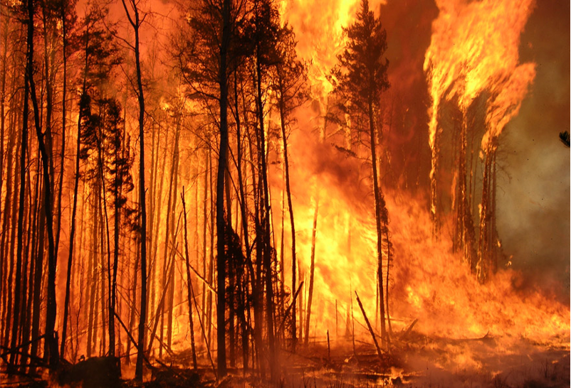
Wildfires are a serious challenge in Canada. (Credit: Canadian Forest Service)
There are no operational satellite systems designed explicitly for routine global wildfire monitoring. However, remote sensing science for active fire detection and burned area mapping is mature, based on the ability to leverage information from existing Earth Observation (EO) data. The Global Observation of Forest Cover and Land Dynamics (GOFC-GOLD) Fire Implementation Team (Fire IT) coordinates downstream science and product developments and has enabled the success of the fire monitoring community. Near-real time distribution of wildfire remote sensing data is also mature, based on systems such as the Global Wildfire Information System (GWIS) and the Fire Information for Resource Management System (FIRMS).

The Global Wildfire Information System (GWIS) Current Situation Viewer.
Almost all applications for wildfire monitoring products are derived from EO systems designed for general purposes. Exploiting these systems for disaster response and management is problematic, largely due to the lack of standardization in EO wildfire products leading to slow adoption rates. Global coordination of the mid- and up-stream wildfire EO initiatives would enable the development of virtual constellations for pre-fire, active fire, and post-fire monitoring, with standardized processing and product delivery, ensuring maximum value to emergency management from EO systems and an efficient adaptation to the increasing threat of wildfires driven by climate change.
Wildfire Pilot
The CEOS Working Group Disasters Wildfire Pilot aims to provide a fundamental basis for defining global priorities for active-fire monitoring and characterization. Take a look at our planned objectives and outcomes below, with more details available in the Wildfire Pilot Implementation Plan.
Objectives:
- Conduct a detailed inventory and gap analysis of existing and proposed EO systems suitable for global active-fire monitoring (considering climate change driven fire regime changes and projected mission life spans)
- Conduct a detailed analysis of global stakeholders and end-users of active-fire EO data
- Define targeted user requirements for active-fire remote sensing systems for the disaster mitigation applications
- Propose a way forward in coordinating global wildfire monitoring activities
Outcomes
- Explore existing and anticipated gaps in wildfire EO capabilities
- Identify the global community of wildfire stakeholders and end-users, and establish a framework for ongoing interaction and collaboration
- Articulate user requirements for active-fire remote sensing
- Propose a way forward to closing existing and future gaps
The pilot project will consider the need for conducting comparable projects for other disciplines of wildfire EO (e.g. pre-fire and post-fire monitoring).
The pilot project will link space- with air- and ground- measurements, where applicable.
The pilot project will include both governmental initiatives and commercial efforts to conduct a detailed inventory and gap analysis of existing and proposed EO systems.
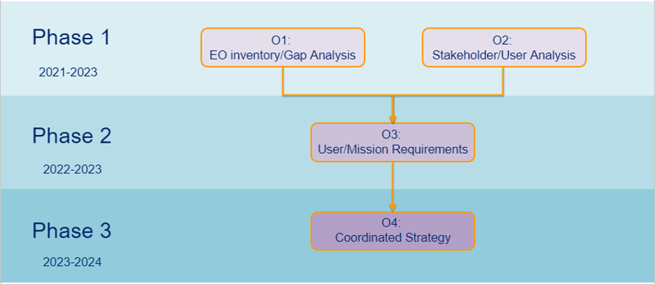
Milestones & Schedule
Progression and dependencies of the 4 pilot objectives are shown below. Results of Objectives 1 and 2 are required to prioritize developments for Objective 3, and all components will be compiled and summarized in Objective 4.
Key End-User Communities
- Wildfire managers and suppression agencies
- Interdisciplinary experts in integrated fire management
- Governmental and regional disaster coordination bodies
- Air quality and health monitoring agencies
- Carbon accounting and land cover/use reporting groups
- Natural resource managers and policy makers
- Forestry, mining, power generation, telecommunications, transportation, infrastructure industrial stakeholders
- Academia, public and private research groups
- CEOS member agencies
Co-Leads
- Joshua M. Johnston, Canadian Forest Service (CFS)
- Helena van Mierlo, Canadian Space Agency (CSA)
- Douglas Morton, NASA
- Peter Moore, United Nations Food & Agriculture Organization (UN-FAO)
 User Implementation Lead: CFS & FAO
CEOS Implementation Lead: CSA & NASA
Contributing Projects
- GOFC-GOLD Active Fire review study
- DLR FireBIRD Mission
- CSA WildFireSat Mission
- NASA-UC Irvine C-FIRES Mission
- NASA Fire Earth Information System Pilot Project