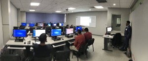
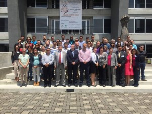
Supporting WGCapD’s mission to help people access and use satellite Earth observation data effectively, we organize free online trainings (e.g. webinars, MOOCs, event live feeds) and some in-person trainings to participants around the globe, often in collaboration with other CEOS Working Groups.
New trainings and webinars are offered periodically. Visit the CEOS Training Calendar for more information about webinars and MOOCs available.
Online Trainings and Webinars
- MOOC [opens November 24, 2021]: Beyond the Visible – Introduction to Hyperspectral Remote Sensing
- MOOC: Echoes in Space: Introduction to Radar Remote Sensing
- August 2021: NASA-ESA Trans-Atlantic Training
- April 2021: Earth Observation Using Satellite Imagery in Urban Planning and Development
- Aug 2020: Satellite Remote Sensing for Air Quality Monitoring and Forecasting
- May 2020: Remote Sensing in Crop Monitoring and Assessment
- December 2019: Webinar Series on Hyperspectral Remote Sensing and its Applications
- October 2019: Geospatial Technology for Wildfire Management Webinar
- September 2019: Future Data Access & Analysis Architecture Initiative Webinar
- December 2018: Sustainable Development Goals (SDG) Awareness Webinar
- June 2017: One Earth – One Health Workshop: Contributions of Earth Observations (EO) to Public Health Practices
- October 2015: Civil Security: Understanding the Risks, Preventing Disasters, and Mitigating the Impacts with Earth Observation (EO) Applications and Services.
CEOS Trainings
- Nov 2020: CEOS Visualization Environment (COVE) Overview Video
- July 2020: An Introduction to CEOS Analysis Ready Data Webinar
In-Person Trainings
Remote Sensing of Land-Use / Cover change and Climate Impacts in Coastal Zones in Phuket, Thailand (17-19 December, 2019) – This training addressed issues and showcased the potential of remote sensing and geospatial technologies in coastal monitoring. For more information, read the Training Report.
Application of Synthetic Aperture Radar (SAR) data to Forestry Change in Nairobi, Kenya (9 August, 2019) – WGCapD organized a tailored pre-conference training on the use of SAR for forestry applications ahead of the 4th annual AfriGEO Symposium and 3rd annual RCMRD International Conference. For more information, read the Training Report.
AEM-CNES Training Workshop on Forest Monitoring in Guadalajara, Mexico (26-28 February, 2019) – This workshop was organized by CONAFOR and AEM to share knowledge on research studies and tools on remote sensing for forest monitoring with a focus on forests fires. For more information, read the Training Report.
Synthetic Aperture Radar Applied in Rice and Forest Monitoring in Hanoi, Vietnam (20-22 February, 2019) – This training built capacity for Vietnamese remote sensing technical experts from academies and universities in applying SAR data and processing technology support rice monitoring, and forest monitoring. For more information, read the Training Report.
Regional Workshops
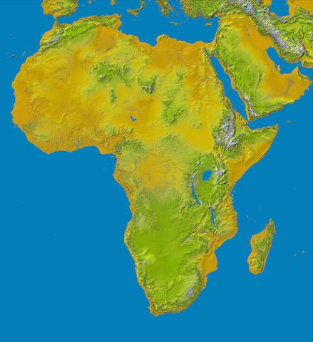
Africa
AfriGEO Activities: In support of GEO’s AfriGEO initiative, WGCapD has strengthened the link between the current GEO activities with existing capabilities and initiatives in Africa and provided the necessary framework for countries and organizations to access and leverage ongoing bilateral and multilateral EO-based initiatives across Africa, thereby creating synergies and minimizing duplication for the benefit of the entire continent.
- 4th Annual AfriGEO Symposium & 3rd Annual RCMRD International Conference in Nairobi, Kenya (9 August, 2019) – WGCapD organized a tailored pre-conference training on the use of SAR for forestry applications. For more information, read the Final Report.
- AfriGEOSS Week and Symposium 2018 in Libreville, Gabon (22-29 June, 2018) – WGCapD organized four days of training courses on the Use of Earth Observations for Environmental Monitoring in Africa. For more information, read the Final Report.
- AfriGEOSS Symposium 2017 in Sunyani, Ghana (13-15 June, 2017) – WGCapD members contributed to two trainings: 1) Google Earth Engine (SERVIR West Africa) Training in Accra, Ghana on 7-8 June with 23 participants (12 from Niger, 8 from Ghana, 3 from Kenya). View the Final Report. 2) Sentinel Data Access and Processing (ESA) Training in Sunyani, Ghana on 11-12 June with 48 participants, coming from 12 countries with a strong majority from Ghana (29 attendees). View the Final Report.
Americas
AEM-CNES Training Workshop on Forest Monitoring in Guadalajara, Mexico (26-28 February, 2019): This workshop was organized by CONAFOR and AEM to share knowledge on research studies and tools on remote sensing for forest monitoring with a focus on forests fires. For more information, read the Training Report.
AmeriGEO Activities: In support of the GEO (Group on Earth Observations) Initiative in the Americas, AmeriGEO, WGCapD promotes collaboration and coordination among GEO members in the American continent to increase the use of Earth observations to inform decision making in four key areas: agriculture, disaster risk reduction, water resource management, and biodiversity. Capacity Building is a foundational, priority activity in the AmeriGEO initiative; as such, the WGCapD, in its role of supporting regional initiatives, helps organizing training events as a part of the annual AmeriGEO Week.
- AmeriGEO Week 2021, “Advancing Collaboration and Data Integration for Decision Support,” took place fully online and is available for future viewing on the AmeriGEO Week 2021 website.
- AmeriGEOSS Week 2018 in São José dos Campos, São Paulo State, Brazil (6-10 August, 2018) – WGCapD organized and delivered a training entitled “Remote Sensing Image Processing for Disaster Response – Use of CBERS-4 and Sentinel Images and INPE and ESA Tools”. For more information, read the Training Report.
- AmeriGEOSS Week 2017 in San Jose, Costa Rica (31 July – 4 August, 2017) – WGCapD organized and delivered a Synthetic Aperture Radar (SAR) Technology course. For more information, read the Training Report.
- AmeriGEOSS Week 2016 in Bogota, Colombia (6-9 June, 2016) – WGCapD supported a two-day SAR training. For more information, read the Training Report and watch the AmeriGEOSS Week video.
Prevention of and Response to Disasters in Mesoamerica: In the context Disaster Management, two workshops were held in Mexico, aiming at presenting, illustrating and promoting the use of Earth Observation (EO) images for disaster reduction. The overall goal was to strengthen both individual and institutional capacities for disaster prevention and relief in countries of Mesoamerica in the use of open-source software in combination with Earth Observation images. Presentations included ongoing work and resources made available by the Global Earth Observation System of Systems (GEOSS), CEOS and the capacity building resources being made available for Latin America and the Caribbean under the EOPOWER project (2013-2015) of the European Commission.
- Workshop on the Use of Space Science and Technology for the Prevention of and Response to Disasters in Mesoamerica in Tuxtla Gutiérrez, México (19-22 November 2013). View the Executive Summary Report.
- Workshop on the use of Open-Source Software and Satellite Data in the Prevention of, and Response to, Disasters in Mesoamerica in Tonantzintla, Puebla, México (19-23 May 2014). View the Executive Summary Report.
Asia/Oceania
Online Training Workshop on Satellite Remote Sensing for Air Quality Monitoring and Forecasting in Thailand (24-28 August, 2020) – this training focused on using satellite remote sensing for air quality monitoring and forecasting in Thailand. For more information, read the Training Report.
Remote Sensing of Land-Use / Cover change and Climate Impacts in Coastal Zones in Phuket, Thailand (17-19 December, 2019): This training addressed issues and showcased the potential of remote sensing and geospatial technologies in coastal monitoring. For more information, read the Training Report.
Synthetic Aperture Radar Applied in Rice and Forest Monitoring in Hanoi, Vietnam (20-22 February, 2019) – This training built capacity for Vietnamese remote sensing technical experts from academies and universities in applying SAR data and processing technology support rice monitoring, and forest monitoring. For more information, read the Training Report.
Online Training Workshop on Satellite Remote Sensing for Air Quality Monitoring and Forecasting in Thailand (24-28 August, 2020) – this training focused on using satellite remote sensing for air quality monitoring and forecasting in Thailand. For more information, read the Training Report.
Data Workshops
Synthetic Aperture Radar (SAR) Data Workshops
SAR remote sensing provides a new dimension for measuring various bio-geophysical parameters of the features on Earth surface. SAR sensors are advantageous in comparison to optical remote sensing because of their day/night capabilities and penetration through even dense cloud cover. Since 2016, CEOS WGCapD has provided the following SAR Training Workshops, on data access, awareness, processing, and applications, to users in developing countries:
- Lusaka, Zambia (10-14 October, 2016) | Workshop Report
- Pretoria, South Africa (January 2017)
- Libreville, Gabon (February, 2017) | Workshop Report
SAR Summerschool – Using Synthetic Aperture Radar Data from Satellite Earth Observations (May 2017)
 WGCapD partnered with the Remote Sensing Education Initiative (SAR-EDU) and the South African National Space Agency in the presentation of a SAR Summerschool at the 37th International Symposium on Remote Sensing of Environment (ISRSE-37).
The Summerschool aimed to transfer knowledge to participants on how to access, use, and interpret satellite Earth observation radar data for geographic, administrative, and scientific applications. One major objective was to enable local users to work with freely available data and processing tools. This activity was intended primarily for participants from institutions, research institutes, and universities in African Countries. Summer school participants needed to already have a basic understanding of remote sensing to benefit from this program. Check the Workshop Agenda.
This free course was provided as a precursor to the ISRSE-37 meeting from May 4th – 7th, 2017 at the Meraka Institute, Council for Scientific and Industrial Research (CSIR).
Digital Elevation Model Training
Background. After the CEOS WGCapD spent several years lobbying alongside the Group on Earth Observations (GEO) and several United States Agencies for the release of Shuttle Radar Topography Mission (SRTM-2) 30-m data, a pilot data release made the data available over a select set of countries (2013). During that time, we worked together to hold the first CEOS Digital Elevation Model (DEM) modeling workshop at the Regional Centre for Mapping of Resources for Development (RCMRD) in Nairobi, Kenya in May, 2013. Later, in conjunction with the 2014 United Nations Climate Summit, the United States government formally announced the release of the dataset globally, enabling us to work with our many partners to host several additional SRTM DEM Workshops and apply these data to important issues, such as flood and volcanic lahar flow prediction.
These training workshops were designed to demonstrate the use of the highest resolution DEM available and, thereby, build capacity in the region in the use and application of DEM data in various thematic areas (e.g. water/water-related disasters).
After the training workshop, participants were able to:
- describe the availability, applications, and limitations of satellite DEMs at varying spatial scales, from sub-meter to 90 m,
- use DEM data for the delineation of river basins,
- use DEM data for flood modeling and inundation mapping,
- understand the accuracies of flood maps produced using DEMs at various spatial scales, and
- describe the applications and accuracies of using DEMs in flood models and inundation maps.
Since 2013, we have organized four workshops for approximately 60 trainees in:
- Nairobi, Kenya (May 6-10, 2013) | Workshop Report
- Pretoria, South Africa (Mar 23-27, 2015) | Workshop Report
- Puebla, Mexico (May 25-29, 2015) | Workshop Report
- Kathmandu, Nepal (Sep 19-22, 2016) | Workshop Report
WGISS Webinars
WGCapD offers additional collaborative capacity building efforts with the CEOS Working Group on Information Systems & Services (WGISS).
The Technology Exploration Interest Group of the CEOS Working Group on Information Systems & Services (WGISS) is a forum for technical information exchange and lessons-learned experience about current and trending software technologies, services, and other internet-related software technologies. Their webinar series is publicly available online. Recent topics include the burgeoning role of python for Earth Observation data analysis and the use of data cubes for large-scale data analytics. Read more…
2019: Future Data Access & Analysis Architecture Initiative Webinar
The CEOS Future Data Access and Analysis Architecture (FDA) initiative has resulted in a range of new approaches for Earth observation (EO) data access and analysis being deployed globally by CEOS Agencies. Many of the pilot activities are now practical implementations with new standards for Analysis Ready Data (ARD), advanced user-programmable Exploitation Platforms, and vast amounts of data readily available on cloud platforms with open source analytics tools like the CEOS Open Data Cube (ODC). Many of these components allow user algorithms to be brought to the data, rather than having to download and run locally, thus opening new opportunities for researchers, industry, and government use. The FDA ecosystem is still evolving and challenging to navigate, and the CEOS Working Groups are collaborating closely to make it simpler to not only discover EO data, but also to exploit it using the various elements of FDA. Watch the recording here.
2017: SAR Data Processing & Applications Webinar Series
This webinar series was intended for academics, scientists, researchers, and professionals interested in Synthetic Aperture Radar (SAR) Remote Sensing, data processing, and applications. SAR remote sensing provides a new dimension for measuring various bio-geophysical parameters of the features on Earth surface. SAR sensors are advantageous in comparison to optical remote sensing because of their day/night capabilities and penetration through even dense cloud cover. Read more… Here you will find some stats and outcomes from this training initiative.
2015: Remote Sensing Technology for Disaster Management Webinar Series
Our 2nd WGCapD Online Course (April-May, 2015) provided eight interactive webinars addressing the use of remote sensing technology for disaster management. Participants learned from space agency experts and policymakers from around the world and increased their awareness of international coordination bodies like CEOS, the Group on Earth Observations (GEO), the United Nations Office for Outer Space Affairs (UNOOSA), and the International Charter for Space and Major Disasters. Participants also learned about useful CEOS tools that might help them access and use satellite data, especially as applied to their disaster management needs. The Lessons Learned Report and the Journal Paper (Ferreira H. S. et al., 2017) for this webinar series discuss lessons learned for future courses. Recorded Webinars and Presentations can be found in our Learning Center.
2013: An Introduction to Remote Sensing Technology E-learning Course
Our first online initiative, an Introduction to Remote Sensing Technology E-learning Course (2013), introduced African university lecturers to accessing and using remote sensing technology and encouraged them to introduce the applications of remote sensing in their own classrooms. Take a look at our Lessons Learned Report for the course. Recorded Classes and Presentations can be found in our Learning Center.