CEOS Development Environment

WGCV-54 & WGISS-58 Joint meeting

Event Dates: October 15th - 18th, 2024

Location: USGS EROS, Sioux Falls, South Dakota, USA

Meeting Information GuideIncludes information on accommodation, transport, social events, and other information about visiting Sioux Falls. 

Photo Album

Week at a Glance:

Tuesday, Oct 15

Wednesday, Oct 16

Thursday, Oct 17

Friday, Oct 18

Joint WGISS-WGCV meeting 

  • Opening Session
  • Agency Reports
  • Maturity Matrices
  • CEOS-ARD

WGCV-54 meeting 

WGISS-58 meeting 

WGCV-54 meeting 

WGISS-58 meeting 

Joint WGISS-WGCV meeting 

  • Interoperability
  • Other joint topics: CEOS Analytics Lab, GCP Match Up Database and Radiometry Database, COVE, SI Traceable Satellites (SITSats), Expressing Uncertainty Information, WGCV Cal/Val Portal, WGISS Connected Data Assets
  • Closing session

Welcome Reception 

6-9pm

Remedy Brewing Company

WGISS & WGCV Dinners

Details TBD


Joint WGISS-WGCV Meeting (15 Oct & 18 Oct)

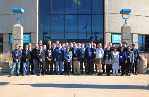
Joint meeting group photo

Presentations

Session A: Opening Session
A.1 – Logistics and Overview of Agenda
A.2 – Welcome from USGS
A.3 – CEOS Executive Officer Report
A.4 – WGISS Chair Report
A.5 – WGCV Chair Report 

Session B: Agency Reports 
B.1 – ISRO 
B.2 – JAXA 
B.3 – NOAA 
B.4 – Geoscience Australia 
B.5 – ESA 
B.6 – CNES 
B.7 – UKSA
B.8 – GISTDA

Session C: Maturity Matrices 
C.1 – WGCV Maturity Matrix
C.2 – WGISS Data Management and Stewardship Maturity Matrix (DMSMM)
C.3 – Interoperability Maturity Matrix

Session D: CEOS Analysis Ready Data (ARD)
D.1 – CEOS-ARD Progress and Product Assessment
D.2 – GitHub and modular approach to CEOS-ARD PFS 
D.3 – Surface Reflectance Quality, Equivalency and Consistency 

Session E: Interoperability 
E.1 – CEOS Interoperability Handbook v2.0 Status 
E.2 – Quality Factor 
E.3 – Common Dictionary/ Vocabulary 

Session F: CEOS Analytics Lab
F.1 – CEOS Analytics Lab 
F.2 – GCP Match Up Database and Radiometry Database 
F.3 – RADCalNet API 

Session G: Joint WGISS/WGCV Topics 
G.1 – SI Traceable Satellites (SITSats) 
G.2 – WGCV Cal/Val Portal 
G.3 – Discussion: Expressing Uncertainty Information 
G.4 – WGISS Connected Data Assets Overview


WGISS-58 (16 & 17 Oct)

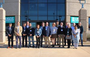
WGISS-58 photo

WGISS-58 Presentations

Session 1: Opening Session
1.1 – Welcome & Review of Agenda
1.2 – Data Preservation & Stewardship Interest Group (DSIG) Work Plan
1.3 – Data Discovery & Access Interest Group (DAIG) Work Plan
1.4 – Data Interoperability & Use Interest Group (DIIG) Work Plan 
1.5 – Technology Exploration Interest Group (TEIG) Work Plan 
1.6 – Select Action Review
1.7 – GEOSS Infrastructure Development Task Team 

Session 2: Collections Management (DSIG) 
2.1 – Session Introduction & Status of Collections Management Work 
2.2 – Archiving Policy at ESA
2.3 – Archiving Policy at NOAA
2.4 – Archiving Policy at DLR 
2.5 – Archiving Policy at JAXA
2.6 – Archiving Policy at USGS
2.7 – Collections Management Best Practice Review and Discussion (continued) 

Session 3: Communications 
3.1 – Discussion: Approval process for WGISS documents 
3.2 – Discussion: How to effectively communicate WGISS Activities? 

Session 4: Heritage Datasets Recovery (DSIG) 
4.1 – Status of AVHRR data recovery work 
4.2 – FDR4AVHRR 
4.3 – Differences between AVHRR L1b/1c satellites products 
4.4 – Australian AVHRR update 

Session 5: Other Data Preservation and Stewardship Topics
5.1 – NOAA Collection Metadata Editing Tool (CoMET) 
5.2 – WGISS DSIG Work Plan 2025-2027 
5.3 – Software preservation White Paper – starting point for discussion 

Session 6: STAC Topics 
6.1- Introduction to STAC in WGISS 
6.2 – INPE STAC Catalog integration in FedEO 
6.3 – CEOS Service Discovery BP – STAC integration 
6.4 – ISRO STAC overview 
6.5 – STAC Summit overview and outcomes 

Session 7: Federated Authentication and Authorization 
7.1 – Introduction to Federated Authentication and Authorization 
7.2 – Integrity Provenance and Trust – OGC Testbed-20 Report 7.3 – Federated Integration of INPE Datasets 
7.4 – Identity Federations at DLR EOC 

Session 8: Technology Exploration 
8.1 – AI/ML White Paper 
8.2 – Jupyter Notebooks Best Practices 
8.3 – Knowledge graphs 

Session 9: Challenges with Data in the Cloud 
9.1 – Review of CGMS Best Practices 
9.2 – Pain points identified by NASA 
9.3 – Digital Earth experiences 

Session 10: Closing Session 
10.2 – Closing Remarks


WGCV-54 (16 & 17 Oct)

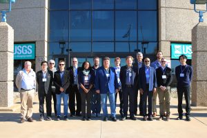
WGCV-54 photo

Presentations

2.3 – WGCV Vice Chair Confirmation
2.4 – Pre-flight Calibration Workshop Update 
2.5 – SRIX4Veg 
2.6 – GHG Cal/Val and Network Updates 
2.7 – Atmospheric Composition Subgroup (ACSG) Report 
2.8 – Surface Reflectance Quality and Consistency 
2.9 – Land Product Validation (LPV) Subgroup Report 
3.2 – Microwave Sensors Subgroup (MSSG) Report 
3.3 – Fiducial Reference Measurement (FRM) Assessment Framework 
3.4 – Infrared and Visible Optical Sensors (IVOS) Subgroup Report 
3.5 – GSICS Collaboration update 
3.6 – Synthetic Aperture Radar (SAR) Subgroup Report  and SARCalNet Update
3.7 – Terrain Mapping Subgroup (TMSG) Report 
3.8 – ACIX-III, CMIX-II and Cloud Camera Network 
3.9 – WGCV support to other initiatives