After the December triggering of the first RO in Haiti, in early 2017, a joint CEOS/GFDRR mission to Haiti was organised to meet with national champions of the project and establish the main elements of the Recovery Observatory Operations Plan (ROOP). Significant input for this ROOP was provided by UNDP, which coordinated the input of a dozen different agencies and international organisations present in the field.
The Recovery Observatory, to be effective, needed be strongly linked to the governmental and international organizations responsible for recovery activities in the affected areas, ideally with a champion within the national government and strong local relays, to ensure user needs are properly addressed.
Three key national users and partners agreed to serve as RO champions within Haiti. They assist in coordinating input from other national users. These are:
Comité Interministériel de l’Aménagement du Territoire (CIAT): the CIAT mission is to define government policy for land use planning, for protection and management of water sheds, water management, urbanism and public works. The institution was created in response to a need for greater coordination between government departments. The CIAT has agreed to play a federating role with regard to user requirements for the RO. CIAT has expressed strong support for the RO concept in an official letter to the RO Team, identifying a need for a recovery baseline documenting damage in the zone, and regular monitoring in relation to agriculture, forests and protected zones, coastal zones and coastal settlements, population movements and rural habitat, as well as landslides and changes to water courses.
Centre National d’Information Geo-Spatiale (CNIGS): the National Centre for geo-spatial information has agreed to be the champion for the RO within the Haiti government, ensuring both delivery of the RO infrastructure in Haiti and serving as a catalyst for capacity building and EO use for disaster recovery within Haiti.
Observatoire National de l’Environnement et de la Vulnérabilité (ONEV): under the ministry of Environment, the ONEV has as objective to create an institutional and technical mechanism for the production, analysis and dissemination of environmental information necessary to support decision making.
The aim of the Observatory is to:
- Demonstrate in a high-profile context the value of using satellite Earth Observations to support Recovery from a major disaster:
- near-term (e.g. support to PDNA process); and
- long-term (e.g. major recovery planning and monitoring, estimated to be from 1 to 3 years).
- Work with the Recovery community to define a sustainable vision for increased use of satellite Earth observations in support of Recovery.
- Establish institutional relationships between CEOS satellite data providers and stakeholders from the international Recovery community.
- Foster innovation around high-technology applications to support Recovery.
The main benefits from the establishment of the Observatory include:
- providing key information (analytical, geospatial) about the Recovery to support end-users in their decision-making processes and progress monitoring;
- obtaining access to regular imaging of affected area over a long period, especially for higher resolution data not typically available;
- compiling in a single framework the key data sets (both satellite images and large number of other data) and use them seamlessly thanks to the DotCloud framework to be established;
- establishing a “real-life” demonstrator to identify where EO can bring useful information in the Recovery phase and define “best practice” for the DRM community;
- demonstrating usefulness of sat EO, together with other datasets, on a large scale for long-term Recovery monitoring;
- demonstrating applications tied to very high resolution imagery and to high frequency high resolution images, to open the way to broader use of satellite EO after smaller and more regular events.
In May 2017, and again in May 2018, the RO team made up of national champions, the French, Italian and Canadian space agencies, and international DRM stakeholders such as UNDP and the World Bank/GFDRR, convened user workshops to bring together RO users around a list of main themes, and to discuss RO products in each of these thematic areas. The main discussion areas were:
- To collect feedback on mock-up products developed in the thematic areas;
- To define the characteristics of the RO platform for document sharing and exchange, and its linkages to other platforms such as HaitiData.Org, KAL-Haiti, RASOR;
- To chart out together the next steps for RO development.
The table below summarizes the key products of the RO at this time: soon online
One of the major outputs of the second user workshop in 2018 was the development of a draft Capacity Building Plan. This plan aims to address both the capacity needs of product generators and developers, and those of organizations struggling to use geospatial information to support recovery planning and monitoring. The plan is still in draft form but will be finalized in fall 2018 and serve as a guide for the coming two years of capacity development activities, ensuring that the legacy of the RO is renewed and strengthened capacity of Haitian user to address the challenges of recovery from major events.
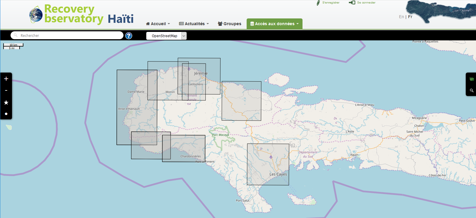
Information and data collected for the RO is available through the RO Platform (Dotcloud infrastructure), the main access point for RO imagery and products. It can:
- display raw and georeferenced images (SPOT, Pleiades, Sentinel-1 & 2, Landsat-8 available at this time; CSK, ALOS-2, TSX, RSAT-2, on demand, and US VHR to follow);
- display information products or other documents (Word files, value-added products in pdf format, etc);
- support geographic and temporal search functions;
- allow networks of users to define communities of practice and share resources available for browsing, download, and upload.
The RO platform is now up and running and more data are being added regularly. It can be found here:
https://www.recovery-observatory.org/

Pleiades CNES Satellite Imagery acquired around 07 October 2016 after Mathew Hurricane
If you are interested in learning more about the RO or would like to contribute data or resources, please contact Hélène de Boissezon (helene.deboissezon@cnes.fr) and Boby Piard, the RO Steering Committee chairs.